Public feedback is credited with changing long-range highway plans in and around the twin cities.
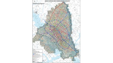
The Bryan/College Station metropolitan planning organization (MPO) unveiled a revised concept map showing more than $2 billion dollars of projects through the year 2050.
MPO executive director Dan Rudge thanked those who provided 1,300 comments during a series of nine public meetings since last October.
Feedback about the revised map is being taken through March 17.
Major changes included changing an extension of FM 2818 from going through Emerald Forest to rerouting via Rock Prairie and a portion of Bird Pond Road.
The MPO also changed Arrington Road from a four-lane a three-lane road.
The revised map consolidates proposed roads in the eastern part of Brazos County to be less intrusive on agricultural and ranching operations.
And there is a slight alignment adjustment to the west side of a proposed outer loop freeway.
The list of projects does not include the Northgate district, which Rudge says by traffic volume during the week is the fourth largest downtown area in the state.
Click HERE to read and download the MPO revised map.
Click below for comments from Dan Rudge, visiting with WTAW’s Bill Oliver.
Audio Player

